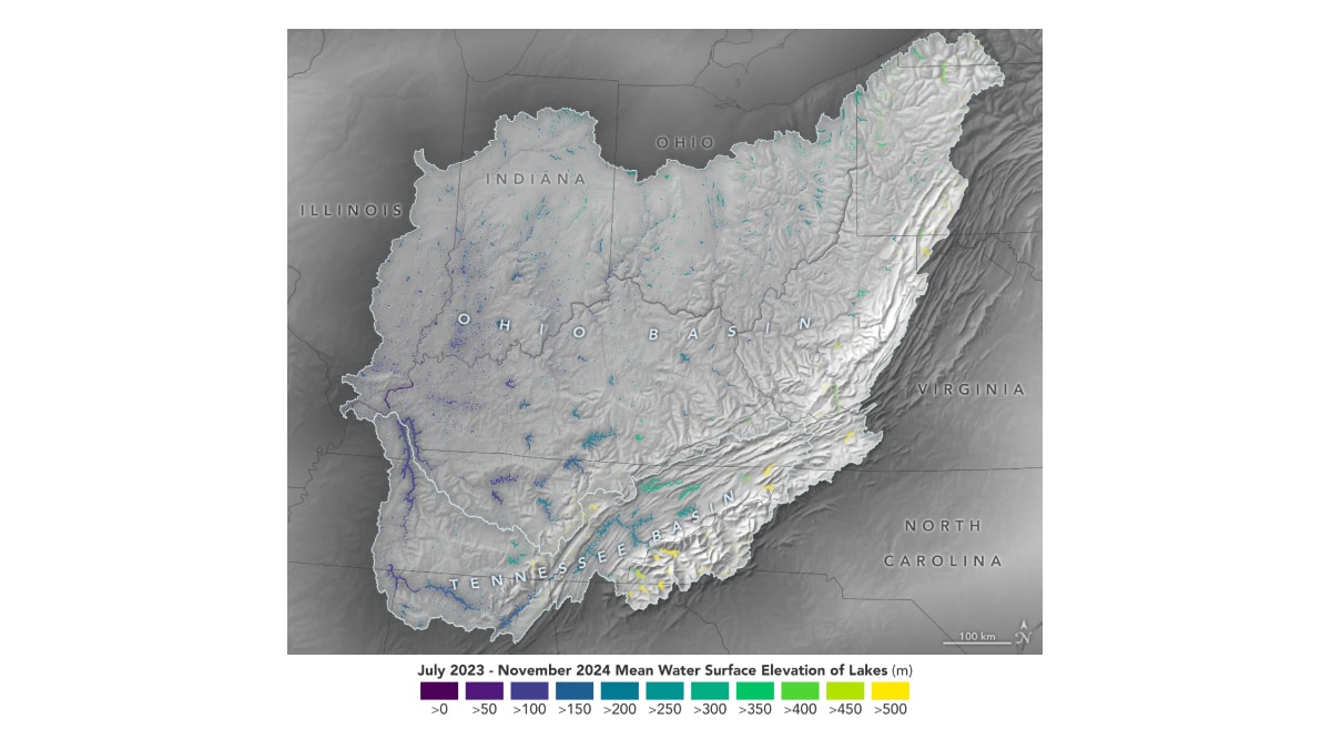
Researchers have been provided with a detailed analysis of lakes and reservoirs in the Ohio River Basin through data collected by the Surface Water and Ocean Topography (SWOT) satellite. According to reports, the U.S.-European mission, a collaboration between NASA and CNES (Centre National d’Études Spatiales), has delivered critical insights into freshwater systems. Spanning an area comparable to France, the basin, which serves over 25 million residents, has been under close observation. The satellite has monitored global water heights across oceans, rivers, lakes, and reservoirs since early 2023, providing comprehensive coverage every 21 days. Its data, released earlier this year, includes water level measurements and spatial extent, offering an unparalleled understanding of water storage and movement.
Significance of High-Resolution Water Data
The information generated by SWOT is being used to calculate changes in water storage over time. As per a report by NASA, researchers can now evaluate river discharge with greater precision, enabling a clearer picture of how water moves through various stretches of rivers. Visual data for the Ohio River Basin, collected between July 2023 and November 2024, show water levels ranging from over 1,600 feet above sea level to under 330 feet, with variations marked in yellow and dark purple. These insights are expected to assist hydrologists in assessing local and watershed-wide water availability, the report further added.
Challenges in Freshwater Data Collection
Sources reveal that understanding water availability has traditionally been hindered by inconsistent data collection methods. While ground sensors and airborne surveys provide some coverage, their spatial and temporal limits necessitate additional data from satellites. However, these measurements often require integration with computer models, which have struggled to accurately represent regulated basins like the Ohio River Basin due to dam operations.
SWOT’s unified approach to measuring water levels and extent is reportedly providing a broader perspective. Colin Gleason, hydrologist and member of the SWOT science team, has stated to various publications that this data facilitates better collaboration among water managers. Researchers are still navigating the extensive data, but the potential to revolutionise water management practices has been highlighted.
For the latest tech news and reviews, follow Gadgets 360 on X, Facebook, WhatsApp, Threads and Google News. For the latest videos on gadgets and tech, subscribe to our YouTube channel. If you want to know everything about top influencers, follow our in-house Who’sThat360 on Instagram and YouTube.


