He was replying to a question raised by Dakshina Kannada MP Brijesh Chowta.
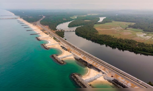
The NCCR study revealed that 17.74 km (48.4%) of Dakshina Kannada’s 36.66 km coastline experienced erosion between 1990 and 2018. In comparison, Udupi district recorded 34.7% erosion (34.96 km of 100.71 km), while Uttara Kannada had the lowest at 12.3% (21.64 km of 175.65 km).
Singh, MoS, Environment, Forest and Climate Change, highlighted findings from the study, noting that 33.6% of India’s coastline is affected by erosion, 26.9% is experiencing accretion (growth), and 39.6% remains stable. He attributed the widespread coastal erosion primarily to rising sea levels along the Indian coastline.
Singh informed the Parliament that the Indian National Centre for Ocean Information and Services (INCOIS) has prepared Multi-Hazard Vulnerability Maps (MHVM) at a 1:25,000 scale for the mainland. These maps incorporate data on extreme water levels, shoreline changes, sea level rise, and high-resolution terrain mapping to identify areas vulnerable to disasters like tsunamis and storm surges, he added.
Speaking to PTI over the phone, Brijesh Chowta said he plans to “tour the affected areas in Dakshina Kannada district after the Parliament session and report back to the minister.”
The NCCR study also highlighted the Karnataka government’s Shoreline Management Plan under the Coastal Regulation Zone (CRZ) Notification, 2019, aimed at addressing coastal erosion. Additionally, the state is implementing the Karnataka Strengthening Coastal Resilience and Economy (K-SHORE) Project with World Bank assistance.
The project focuses on enhancing coastal protection, improving community livelihoods, and addressing marine plastic pollution. NCCR continues to monitor shoreline changes using multi-spectral satellite imagery and field-surveyed data.


